Aerial Imagery & GIS Mapping/Analysis: Stimson Farms
Iowa
Location
Mat Edwards
Contact
Service Lines
Project Summary
Iowa received record rainfall in 2019. The Missouri River basin received more runoff in three months than it typically gets in a year. Some farmers in Southwest Iowa found their crops flooded multiple times this spring, causing them to evaluate crop insurance and replanting considerations. Jesse Stimson of Stimson Farms, LLC, found himself in that exact situation. He approached Blackstone Environmental to fly his flooded fields and create GIS maps to aid his crop insurance and replanting efforts.
Services Provided
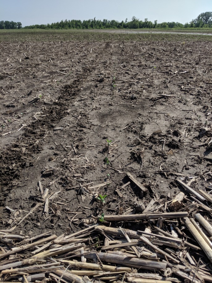
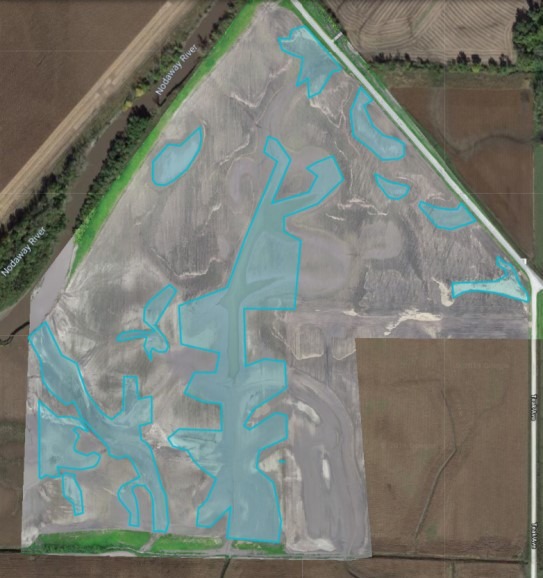
Aerial Imagery from Drone: Blackstone’s FAA-licensed drone pilot was deployed to Stimson Farms, near Braddyville, Iowa. He began creating a flight plan to map flood damage and areas that would likely require replanting. After carefully considering the local terrain, airspace restrictions, and potential landing areas, Blackstone began mapping each flooded field. Damaged crops were photographed in specific locations to create a "boots-on-the-ground" connection between the drone imagery and actual crop conditions in the field. Each flooded area was mapped using drone imagery and overlaid in GIS software with elevation data (LiDAR), soil type, and surface drainage maps to allow a GIS analyst to create replant maps.
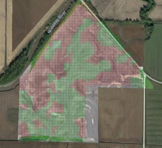
GIS Mapping & Analysis: A GIS analyst with a strong background in agronomy, soil chemistry, and machine control used GIS software to create replanting maps for each flooded field. Flooded areas were mapped on the drone imagery, compared with the elevation maps, and plotted in GIS software with an appropriate replant seeding rate depending on the severity of the damage to the standing crop. A visual example of the analysis process is shown in Figure 3. Stimson Farms used the replanting ‘prescription maps’ as the machine control file in the tractor to replant each flooded field. Without Blackstone’s Drone and GIS services, Stimson Farms would have manually replanted the flooded areas, likely wasting fuel, time, and seed in areas where the existing crop was not severely impacted by floods.